Navigating Delhi can be overwhelming, but the Delhi Metro is here to save the day! With its vast network, the Delhi Metro Map is your best friend for exploring the city efficiently.
Understanding the Delhi Metro Map
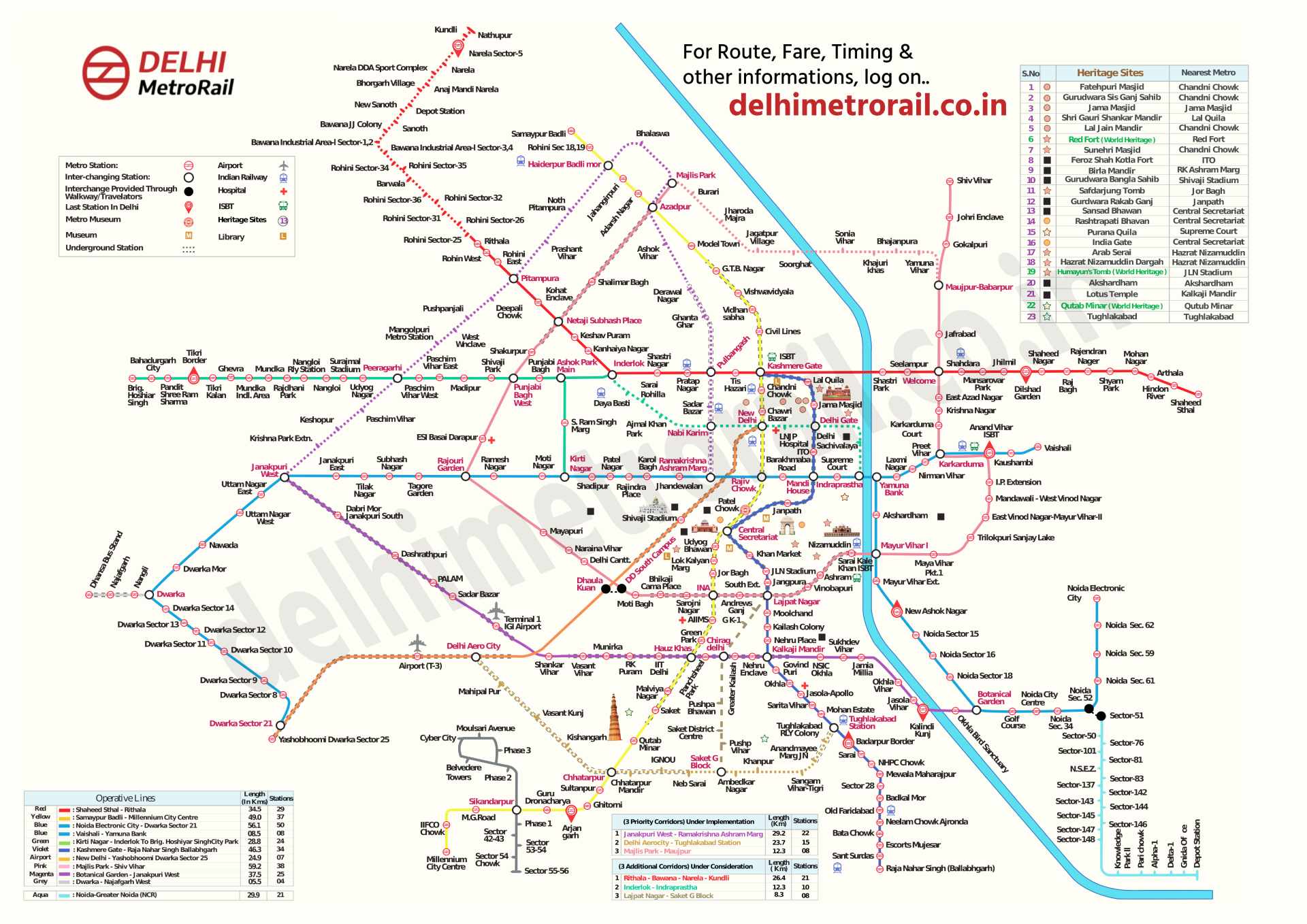
The Delhi Metro Map is a visual representation of the entire metro network, including all operational lines, stations, and interchange points. It’s designed to help passengers plan their routes efficiently and understand the connectivity between different parts of the city.
Key Features of the Delhi Metro Map
Color-Coded Lines: Each metro line is represented by a different color, making it easy to identify and follow on the map. For instance, the Yellow Line connects Samaypur Badli in the north to HUDA City Centre in the south.
Interchange Stations: These are pivotal points on the map where you can switch from one metro line to another. Notable interchange stations include Rajiv Chowk, Kashmere Gate, and Hauz Khas.